On the basis of the «Deep Vision» technology we can offer the following services:
1. QUICK REMOTE TERRITORY DIAGNOSTICS allows checking whether mineral deposits are present or absent in an investigated territory. It is executed with the help of the method of radiation technical treatment of analog space photo. Work duration is nearly one month, the reliability of results is more than 80 %. As a result of this stage, a Customer will receive an information about the presence or absence of mineral deposits in the territory, without ground contours of deposits and other deposit characteristics.
Application range:
- Estimation of land plots at a tender to choose of the most prospective plot
- Estimation of land plots in the course of obtaining land title
- Determination of prospective territories for business development
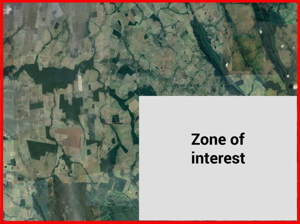
For example, we have an area of less than 300 sq.km.
![]()
The answer about the presence or absence of deposits will be simple:
YES
or
NO
If we have an area more than 300 sq.km., for example, 500 sq.km., we are able to give little bit more analytical information about some zones for further investigation
2. REMOTE SEARCH OF DEPOSITS and their approximate estimation includes detection of mineral deposits in the surveyed territory, determination of their ground contours and preliminary occurrence depths. Duration of work is nearly 2 months, the reliability of results is more than 90 %. As a result of this stage, the Customer will receive a report with ground contours of detected mineral deposits which were pointed in search requirements. Rough occurrence depth of the deposits is also underlined.
Application range:
- Search for mineral deposits in large territories
- Determination of the most prospective area for the future survey
- Preliminary contours of the deposit
- The preliminary depth of bedding
Returning to our area 500 sq.km
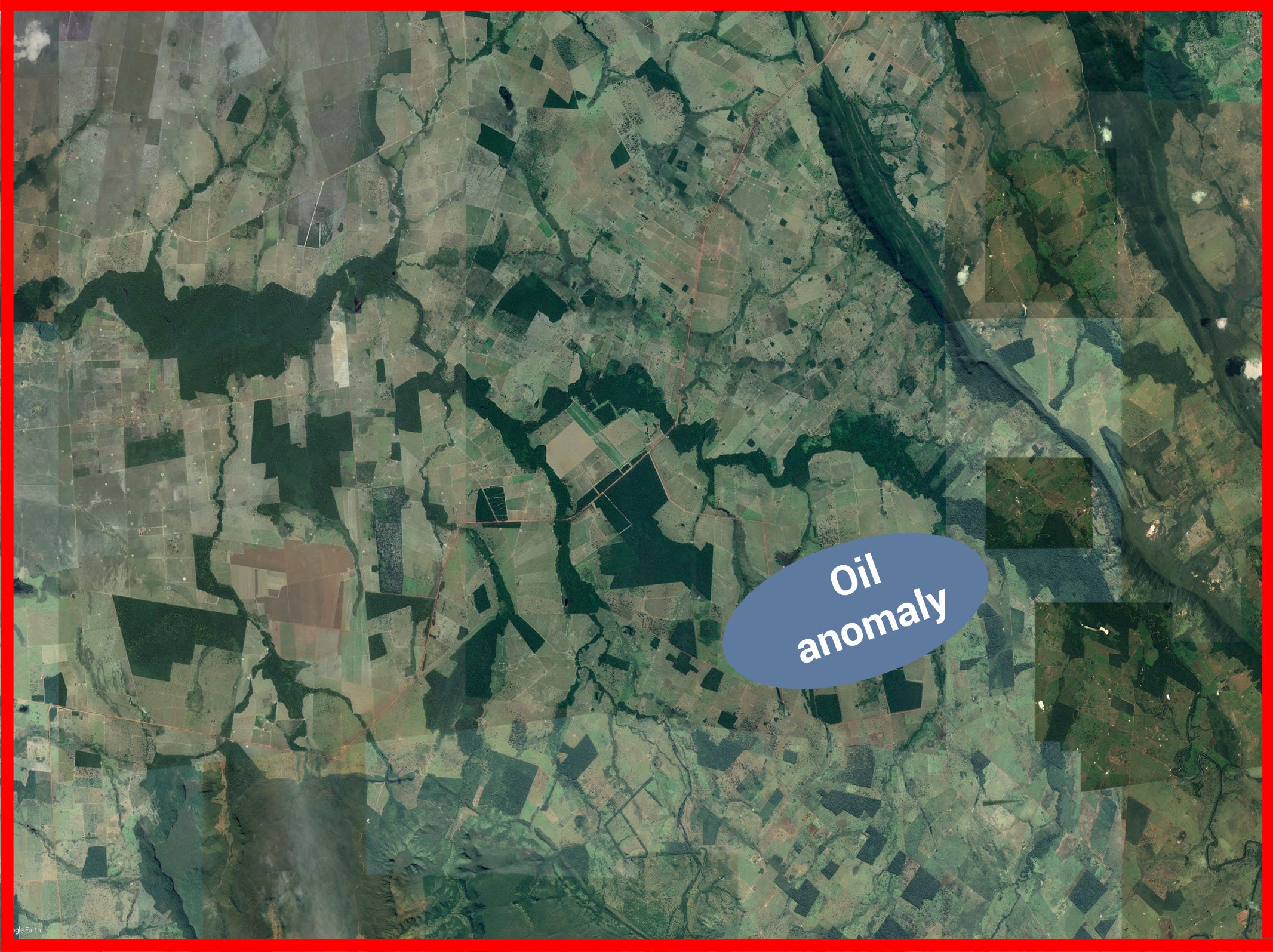
As a result of the 1st stage we obtained:
- 1 oil anomaly with their preliminary contours
- preliminary depths of bedding near 1500 meters.
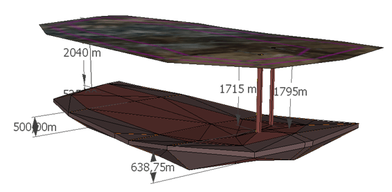
3. ON-SITE DEPOSIT PROSPECTING determines the exact characteristics of the deposits (margin of error for ground-level contours of deposit is ±10 m, margin of error for occurrence depth is less than 1,5 %). Subsequently, we create the 3D shape of the deposits and help to choose optimum points for productive drilling. Work duration is nearly 2 months, the reliability of results is more than 95 %.
Application range:
- Prospecting of the deposits detected at the previous stage
- Conduct of complementary prospecting of the deposits in operation
- Conduct of the deposit prospecting with the purpose of data verification received by the other methods of geological prospecting
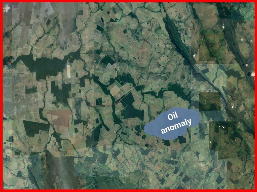
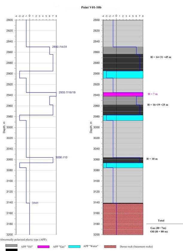
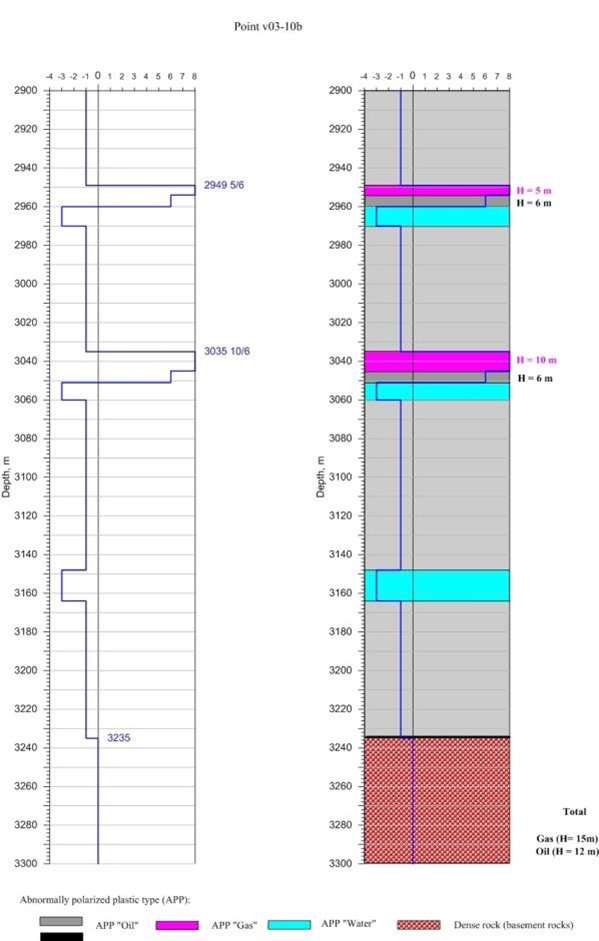
As a result of the 2nd stage we obtained:
- Exact contours of oil anomaly
- Exact depths of bedding for each horizon

4. DETERMINATION OF PROSPECTIVITY of well drilling. Work duration is nearly 1 month.
We can do point investigation and give above-mentioned information exact depths of bedding for each horizon
5. CREATION OF THE MAP of mineral deposits of the territory or region. Cost and duration of work depend on the size of the territory and quantity of the investigated minerals.